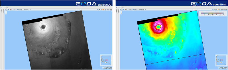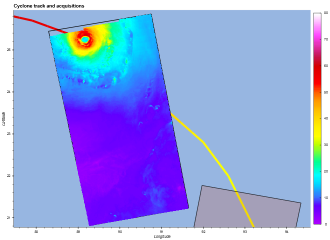
In the case of Dorian, three images from European Sentinel satellites coincided perfectly with the hurricane trajectory, making it possible to estimate maximum ocean surface sustained wind speeds above 60 m/s on August 30th before Dorian reached the Bahamas. In addition, Canadian satellite RadarSat-2 imagery was made available on September 1st, with support from public funds* received in the framework of the VIGISAT project managed by “Groupement Bretagne Télédétection” (GIS BreTel – Brittany Remote Sensing). On September 1st, maximum ocean surface sustained wind speeds reached more than 80m/s as Dorian approached the Bahamas.