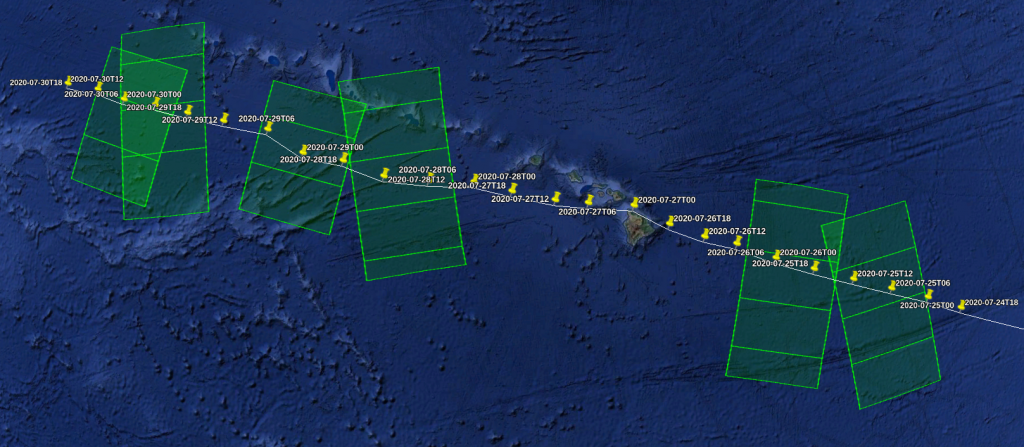
When a Tropical Cyclone (TC) warning is issued (usually when it is still at the tropical storm stage), CYMS team retrieves the storm track forecasts from ECMWF (https://www.ecmwf.int/en/forecasts/charts/tcyclone/). ECMWF is used since it provides Tropical Cycloneforecast tracks over all ocean basins.
Sentinel-1A & Sentinel-1B ground tracks and swaths are overlaid to see when/where they should be collocated with the tropical cyclone over ocean for the following 5 days. For those collocated areas (highlighted squares in the map above), late programming is requested to ESA mission planning team, in IW (Interferometric Wide swath) over coastal areas or in EW (Extra Wide Swath) to maximize the covered area. The possibility to perform Extra Wide Swath partly depends on the background acquisition plan and associated applications which are specified in the High Level Operation Plan (HLOP, available here).
Both modes also have dual-polarization capabilities, which is important to ensure that the Radar signal for extreme-force winds is not saturated.
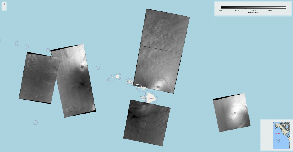
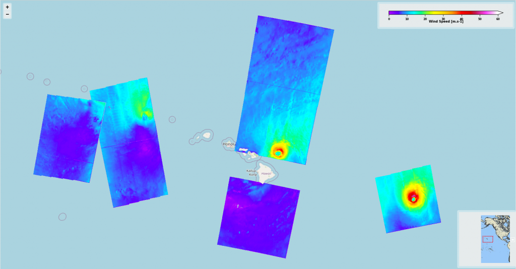
When the data are acquired, they are retrieved by the CYMS team via the ESA CopHub within 3 hours after acquisition, but also disseminated through the normal Sentinel-1 data distribution channels, Scihub. CYMS team then uses sea surface roughness plus additional ancillary information to derive the sea surface wind, speed and direction, using algorithms dedicated to extreme winds (references available at https://www.esa-cyms.org/documentation/). The SAR image can also be used to estimate other parameters like the maximum wind radii, Tropical Cyclone eye location and size, rain-affected regions or the wind direction.
Information from other satellite missions can also be used for comparison to complement the SAR-based-observations: e.g. GPM (Imerg) for precipitation, SMOS data for wind speed.
Output CYMS data are distributed on EODA and Cyclobs for a large user community, including Regional Specialized Meteorological Centre (RSMC) and Tropical Cyclone Warning Centre (TCWC), in charge of detecting cyclonic activities in their region, forecast their evolution and issue warnings to the authorities and populations to reduce loss of life and damage caused by tropical cyclones to a minimum.
Final Sentinel-1 acquisitions and derived sea surface winds are shown in the figure below. The acquisition over Hawaii island, not present in the Sentinel-1 passes specifically acquired for Douglas monitoring, is part of the nominal planning.